
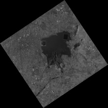
SPADEX (Space-craft Docking Experiment) is based on the low docking concept using two small satellites. Docking refers to engaging and securing the two spacecraft together by a docking mechanism when the approaching spacecraft called the “SDX01” flies directly into another spacecraft called the “SDX02” in a controlled manner.
The primary objectives of SPADEX experiment are to:
-
To Develop and demonstrate the technology needed for rendezvous and docking, using two small satellites.
The secondary mission objectives are to:
-
Demonstrate the controllability of SDX01 & SDX02 in the docked condition.
Data Access
Data Version
- Version 1.0 (beta)
Data Sources
High resolution camera data
Data Citation
NA
Processing Steps
-
Data decoding by extraction of raw image frames from payload data files.
- Radiometric correction for all frames using Look Up Table application to convert raw frames to rad frames
-
Geometric Correction to rectify geometric distortions in the frames and generating geo corrected frame TIFs in WGS-84 datum.
References
[1]Lowe, David G. "Distinctive image features from scale-invariant keypoints." International journal of computer vision 60.2 (2004): 91-110.
Derivation Techniques and Algorithm
Geo corrected frames are refined using control points estimated using Scale Invariant Feature Transform (SIFT) has been described in detail in [1].
Limitations
NA
Known problems with data
There can be some noise in the frames
File Naming Convention
The typical file name ‘PLDXXSTNP#SATORBNOVCAPIdYYDDDHHMMSSMSE_Vm_n_geo_refined.tif’,
Ex:HRCXXMU2P1SD10407001NNNN25264054328469_V1_1_geo_refined.tif where:
-
'PLD' stands for Payload name, ex: HRC.
-
'STN' stands for Station-id, ex: MU2.
-
'P#' stands for P1/P2.
-
'SAT' stands for satellite name, ex: SD1
-
'ORBNO' corresponds to the orbit number, ex: 04070
-
' YYDDDHHMMSSMSE ' corresponds to the file closing time after data is received.
-
‘YY’ is Year Integer Value.
-
‘DDD’ is Julian Day Integer Value.
-
‘HH’ is Hour Integer Value.
-
‘MM’ is Minutes Integer Value.
-
‘SS’ is Seconds Integer Value.
-
‘MSE’ is Milliseconds Integer value
-
‘m’ signifies major version number while ‘n ‘signifies minor version number.
-
All the data files are in GeoTiff format.
MetaData
| Sr. No | Core Metadata Elements | Definition | ||
| 1 | Metadata language | English | ||
| 2 | Metadata Contact | MOSDAC | ||
| 3 | Metadata date |
March, 2026 |
||
| 4 | Data Lineage or Quality |
Geo corrected frames |
||
| 5 | Title |
High resolution camera geo corrected frames from SPADEX mission |
||
| 6 | Abstract |
The data products will be used for natural resource study |
||
| 7 | Dataset Contact |
K.Suresh, PSPD/PMPG/SIPA SAC (ISRO), Ahmedabad-380015, India. Ph:+91 79 2691 4710.Email: ksuresh@sac.isro.gov.in Shweta, PSPD/PMPG/SIPA SAC (ISRO), Ahmedabad-380015, India. Ph:+91 79 2691 4765.Email: shwetaverma@sac.isro.gov.in |
||
| 8 | Update Frequency |
One time |
||
| 9 | Access Rights or Restriction | Open Access | ||
| 10 | Spatial Resolution |
4.5 m |
||
| 11 | Language | English | ||
| 12 | Topic Category |
Geo corrected frames using HRC payload data. |
||
| 13 | Keywords |
HRC, Geo corrected, SPADEX. |
||
| 14 | Date or period |
May 2025 – Apr 2026 |
||
| 15 | Responsible Party |
PSPD/PMPG/SIPA SAC (ISRO), Ahmedabad-380015 |
||
| 16 | Organization | Space Applications Centre (ISRO), Ahmedabad, India | ||
| 16a | Org. role |
Data processing for HRC payload |
||
| 16b | Individual name |
Shweta Verma |
||
| 16c | Position |
Scientist/Engineer-SD |
||
| 16d | Vertical Extent (minimumValue, maximumValue, unitOfMeasure, vertical datum) | NA | ||
| 17 | Geographic Extent |
|
||
| 18 | Geographic name, geographic Identifier |
Global Data |
||
| 19 | Bounding box |
Lat_min: 40S, Lat_max: 40N Lon_min: 0E, Lon_max: 180E |
||
| 20 | Temporal Extent |
Scene wise |
||
| 21 | Access Rights or Restrictions | Open Access | ||
| 22 | Distribution Information |
Online download of data files in GeoTiff format |
||
| 23 | Processing Level | Level 2 | ||
| 24 | Reference System | Datum: WGS84 |


